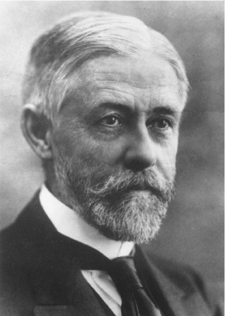
1863 - 1925
William Stewart was born in Ottawa and graduated from Collegiate School, later Lisgar Collegiate, in 1880 with first class honours. He graduated from RMC in 1883 as top of his class with the Governor General's Gold medal. Six years later, he was appointed Canada's first hydrographic surveyor, and in 1904, having obtained his Master's Papers (Inland Waters) in Kingston, he was appointed Chief Hydrographic Surveyor of the Canadian Hydrographic Service.
For the remainder of his life, Stewart worked in this position, charting Canada's inland and coastal waters. Between 1885 and 1925 when he died, he is credited with preparing approximately 170 navigation charts of Canada, either as the actual draftsman, or in their planning and production as the Chief Administrative Officer of the Canadian Hydrographic Service. He is responsible for the surveys of such waterways as Georgian Bay, Burrard Inlet, Lake St Clair, Lake Erie, Lake Huron, Lake Winnipeg, Parry Sound, and Lake Superior.
In 1907, Stewart was appointed to the International Waterways Commission of which he became Head Commissioner and assisted in the determination of the boundary between the United States and Canada. He was named Consulting Engineer to the Prime Minister and the Department of External Affairs in 1912, consulting on International Joint Commission issues relating to Canada and the United States. At the request of the British Government, he assisted in the layout in Europe of the new international boundaries as determined by the 1919 Treaty of Versailles.
Upon his death at 62, William Stewart was, within the International Astronomical Union, an executive member of the Oceanography section of the National Committee of Canada; as well as a member of the International Union of Geodesy and Geophysics; the Engineering Institute of Canada; the American Society of Civil Engineers; the Institution of Civil Engineers, London, England; the Geographic Board of Canada; and the Royal Astronomical Society of Canada.
Plaque inscription:
Scholar, Chief Hydrographic Surveyor of Canada, International Boundary Expert